
Monday, July 16, 2012
Plymouth Rock
One of my earliest memories was a trip to Cape Code with my grandparents. I remember playing on the beach (getting sunburned) and visiting Plymouth Rock. I know it's been broken up and moved around and who really knows if it's true but it's the symbolism that it represents that draws us to it. Making that first step into a new world. The unknown challenges ahead but still stepping off the boat and going ashore. So it's fitting that I should start the next leg of my journey at the rock. At a place when I first remember being me. The pilgrims came here to start a new life. I'm here to remember an old one and make new memories. All ashore.

Friday, July 13, 2012
Errata and Perkins Drive
Errata: The boulders and debris left behind by receding glaciers.
The hills around the area I grew up where formed by the glaciers durining the last ice age leaving piles of rock and exposed areas. I didn't know that glaciers still existed until I moved to Seattle. Now I've hiked and climbed and even spent the night sleeping on a glacier at 8000 ft.
It's interesting and enevatble to compare and contrast where I came from and what I've done. New York to Washington and everything in-between. I can trace the trail of errata that occurred and has been left behind as I moved along. I've come back home and now it's time to move out again.
I came home 4 weeks into my sophomore year of college and wanted to drop out. My mothers reply. "Do what you want.". No discussion. No advise. When I visited her now she said the same thing to me. "you can leave now, go do what you want". I was never pressured to do anything and left alone to make my own choices. I guess that's how I got here now.
Perkins Memorial Drive is a road that leads up to an old fire lookout tower. The hill has been used since revolutionary times as it looks over the Hudson River. The road is a favorite from my past motorcycle days. It was so much fun yesterday I went up and down it twice. From the top you can see the skyline of New York City ( 40 miles away), the Hudson River north and south, West Point Military Academy and the rolling hills around the valley.


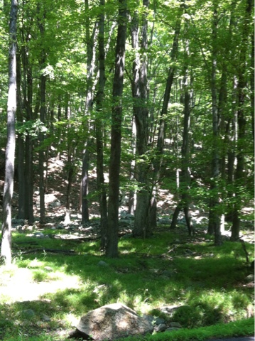


The hills around the area I grew up where formed by the glaciers durining the last ice age leaving piles of rock and exposed areas. I didn't know that glaciers still existed until I moved to Seattle. Now I've hiked and climbed and even spent the night sleeping on a glacier at 8000 ft.
It's interesting and enevatble to compare and contrast where I came from and what I've done. New York to Washington and everything in-between. I can trace the trail of errata that occurred and has been left behind as I moved along. I've come back home and now it's time to move out again.
I came home 4 weeks into my sophomore year of college and wanted to drop out. My mothers reply. "Do what you want.". No discussion. No advise. When I visited her now she said the same thing to me. "you can leave now, go do what you want". I was never pressured to do anything and left alone to make my own choices. I guess that's how I got here now.
Perkins Memorial Drive is a road that leads up to an old fire lookout tower. The hill has been used since revolutionary times as it looks over the Hudson River. The road is a favorite from my past motorcycle days. It was so much fun yesterday I went up and down it twice. From the top you can see the skyline of New York City ( 40 miles away), the Hudson River north and south, West Point Military Academy and the rolling hills around the valley.
Wednesday, July 11, 2012
Bakery and Biking
With most of the work and maintenance done on the RV it's back to exploring. This morning I found the Entenmenn's Bakery Outlet. What a deal. My favorite coffee cake, Danish ring and cookies and some almond biscotti for $7. I froze half the goods and eating the rest now. Yum.
Near by there is Stewart State Forest. It's a 6000 acre park full of trails. It started in the 70's as the state buying up land next to Stewart Air National Guard base to develop it as a supersonic airport. That didn't happen but the exciting airport was an emergency landing option for the space shuttle. The state turned it into a park and took down all the houses and farms.
Location: http://maps.google.com/maps?f=q&hl=en&geocode=&q=41.51281,-74.15793&ll=41.51281,-74.15793&ie=UTF8&z=12&om=1
I met some people on mountain bikes as they where leaving and got tips on a good trail. Worked out well and got a challenging 6 mile single track ride in. With it being old farms it's not odd to see lots of old rock walls piled up from when they cleared the fields just different from out west. The forests are different too. Lots of trees but not much underbrush. Like the area around the house I grew up in. You can almost walk where ever you want. It's been in the 80's to 90's but feels good after being above 100.
On the way home I stopped to do some laundry (I've been using friends up till now) and chose the laundromat because there is an Italian restaurant next door and they have wifi. Clean sheets, eggplant parmesan hero and blogging. Life is Good.


Near by there is Stewart State Forest. It's a 6000 acre park full of trails. It started in the 70's as the state buying up land next to Stewart Air National Guard base to develop it as a supersonic airport. That didn't happen but the exciting airport was an emergency landing option for the space shuttle. The state turned it into a park and took down all the houses and farms.
Location: http://maps.google.com/maps?f=q&hl=en&geocode=&q=41.51281,-74.15793&ll=41.51281,-74.15793&ie=UTF8&z=12&om=1
I met some people on mountain bikes as they where leaving and got tips on a good trail. Worked out well and got a challenging 6 mile single track ride in. With it being old farms it's not odd to see lots of old rock walls piled up from when they cleared the fields just different from out west. The forests are different too. Lots of trees but not much underbrush. Like the area around the house I grew up in. You can almost walk where ever you want. It's been in the 80's to 90's but feels good after being above 100.
On the way home I stopped to do some laundry (I've been using friends up till now) and chose the laundromat because there is an Italian restaurant next door and they have wifi. Clean sheets, eggplant parmesan hero and blogging. Life is Good.
Friday, July 6, 2012
New York State of Mind
I made it into New York on July 3rd. I've been busy visiting and working on the RV. I'm parked in a friends driveway and trying to stay cool although looks like a break in the weather and only into the 80's and low 90's. Since I've been doing lots of things I'm posting some random thoughts and pictures as I go along. I'll add things as I go or make a new post if something special comes along.
I tinted all the back windows on the RV and made solar shades for the inside. Should help with the RV heating up during the day. I also found a loose vacuum hose that was affecting the AC not working. It seems to be better.
First impression: bad roads and lots of traffic.
You are not allowed to pump your own gas in New Jersey.
Went to visit Orange County Choppers world headquarters. Didn't buy anything but cool to see the bikes in person. Didn't make it on TV or see any of the characters.
New York has a bunch of roads/parkways that RV's and trucks are not allowed on. Like all the roads in the state park I wanted to visit.
I am getting my fill of New York style pizza actually made in New York.
I had a real NY bagel and cream cheese. Yum.
Before there was REI and Cabela's there was Ramsey Outdoor. I found some cool "Life is Good" t-shirts at Ramsey Outdoor and returned/replaced a broken bicycle pump at REI store #140 in Paramas, NJ.
7/10/12. Tool the motorcycle out for a ride and went to see mom again. She was better but still a little off. Took the long way back to the RV through Harriman State Park. More bad roads and some good ones. A few of my old favorite motorcycle rides. Checked in about camping and using the kayak on some of the lakes. New York State doesn't recognize my sit on top kayak as a "boat" so I can't pay the $30 to float on a lake for the day. It's getting time to move on.
Expenses to date:
Miles: 4350
Gallons gas: 593
Gas $: $2076
Food: $315
Camping: $553
Misc: $375.29
Overall ave weekly exp $475 keeps me on budget for the year. Yeah I get to keep going!
I think being on the east coast I'll be able to travel less and see more stuff. Unless I end up in Newfoundland :-)


I tinted all the back windows on the RV and made solar shades for the inside. Should help with the RV heating up during the day. I also found a loose vacuum hose that was affecting the AC not working. It seems to be better.
First impression: bad roads and lots of traffic.
You are not allowed to pump your own gas in New Jersey.
Went to visit Orange County Choppers world headquarters. Didn't buy anything but cool to see the bikes in person. Didn't make it on TV or see any of the characters.
New York has a bunch of roads/parkways that RV's and trucks are not allowed on. Like all the roads in the state park I wanted to visit.
I am getting my fill of New York style pizza actually made in New York.
I had a real NY bagel and cream cheese. Yum.
Before there was REI and Cabela's there was Ramsey Outdoor. I found some cool "Life is Good" t-shirts at Ramsey Outdoor and returned/replaced a broken bicycle pump at REI store #140 in Paramas, NJ.
7/10/12. Tool the motorcycle out for a ride and went to see mom again. She was better but still a little off. Took the long way back to the RV through Harriman State Park. More bad roads and some good ones. A few of my old favorite motorcycle rides. Checked in about camping and using the kayak on some of the lakes. New York State doesn't recognize my sit on top kayak as a "boat" so I can't pay the $30 to float on a lake for the day. It's getting time to move on.
Expenses to date:
Miles: 4350
Gallons gas: 593
Gas $: $2076
Food: $315
Camping: $553
Misc: $375.29
Overall ave weekly exp $475 keeps me on budget for the year. Yeah I get to keep going!
I think being on the east coast I'll be able to travel less and see more stuff. Unless I end up in Newfoundland :-)
Tuesday, July 3, 2012
Going East and Back in Time
Today was about driving again. I was in 5 different states, which is easier to do on the east coast. Virginia, West Virginia, Maryland, Pennsylvania, and New York. The further east you go the older the mountains are and the older the roads get with worse conditions. The town I'm spending the night in was founded in 1690. And it seems the drivers get worse too. After seven hours of moving I stopped at the closest KOA to home (mostly for the wifi). It's on a nice little river (although it's no Shenandoah). So what else can I go but paddle up stream again. This one is the Neversink River. It's was running fast in areas but still shallow enough that eventually I couldn't get over the rocks. Yesterday's practice helped but it was moving to fast and I didn't want to walk the shallows. A good days driving, playing in the water to wash out the cobwebs and easy drive to the old home front tomorrow
Music: The singing of the tires on the road and the thoughts in my head.
Miles: 348


Music: The singing of the tires on the road and the thoughts in my head.
Miles: 348
Monday, July 2, 2012
Driving the ridges & Paddling upstream.
Last night after my run I was able to take a shower without turning the water heater on. The water was warm enough just from the heat of the day. the RV just soaks up the heat. Overnight the temperature dropped to the mid 70's and it was cool sleeping.
Today was driving the northern 80 miles of the Blue Ridge Parkway and the entire 105 miles of the Skyline drive. They are definitely two of the most scenic roads meant for travel.y average speed including a few short stops was 35 mph. The speed limits are 45 and 35. Views every where but don't look too long because there's another turn coming. I made a couple of videos so you can get the feeling. They are 3-4 minutes each. Nothing dramatic (except the view) so watch what you like.
After 6 hours of driving I ended up at the Shenandoah River State Campground. Parked. Lowered the kayak and off to the water. Without a shuttle my only choice is to paddle upstream first. It was good enough for Lewis and Clark. The river report was below normal at 650 cfm and water temp 80°. Some areas where easy to get up and others more challenging. Like climbing stairs sitting down facing up. I measured the river speed at 2 miles per hour and I can paddled against the flow at 4 mph. So up I went. About a mile up it got really shallow so I turned around and floated back. If was fun trying to read the water and find the flows.
They had an electrical storm last week as well as the recent wind storm and there are wild fires in the area. So if the photos look like smoke, it is. (except the one of me, I was using the waterproof cover)
(I'll imbed the videos next time I can get the computer online. It's to hard with the iPhone)
Link to Blue Ridge Parkway
http://www.youtube.com/watch?v=VpabhO912TY
Like to Skyline Drive
http://www.youtube.com/watch?v=k4HxnZ9XMTA
Link to river
http://www.youtube.com/watch?v=MvKo-cxXFpc
Miles: 216
Music: Genius mix.
Bears: 1
Wild Turkeys: 2
Deer: 3
Rabbits: to many to count


Today was driving the northern 80 miles of the Blue Ridge Parkway and the entire 105 miles of the Skyline drive. They are definitely two of the most scenic roads meant for travel.y average speed including a few short stops was 35 mph. The speed limits are 45 and 35. Views every where but don't look too long because there's another turn coming. I made a couple of videos so you can get the feeling. They are 3-4 minutes each. Nothing dramatic (except the view) so watch what you like.
After 6 hours of driving I ended up at the Shenandoah River State Campground. Parked. Lowered the kayak and off to the water. Without a shuttle my only choice is to paddle upstream first. It was good enough for Lewis and Clark. The river report was below normal at 650 cfm and water temp 80°. Some areas where easy to get up and others more challenging. Like climbing stairs sitting down facing up. I measured the river speed at 2 miles per hour and I can paddled against the flow at 4 mph. So up I went. About a mile up it got really shallow so I turned around and floated back. If was fun trying to read the water and find the flows.
They had an electrical storm last week as well as the recent wind storm and there are wild fires in the area. So if the photos look like smoke, it is. (except the one of me, I was using the waterproof cover)
(I'll imbed the videos next time I can get the computer online. It's to hard with the iPhone)
Link to Blue Ridge Parkway
http://www.youtube.com/watch?v=VpabhO912TY
Like to Skyline Drive
http://www.youtube.com/watch?v=k4HxnZ9XMTA
Link to river
http://www.youtube.com/watch?v=MvKo-cxXFpc
Miles: 216
Music: Genius mix.
Bears: 1
Wild Turkeys: 2
Deer: 3
Rabbits: to many to count
Sunday, July 1, 2012
Blue Ridge Parkway
Made the move into Virginia today and up onto the Blue Ridge Parkway. I started driving today with no place reserved to stay the night. I knew there where camp grounds on the parkway but didn't know how far I would get. It's a different kind of traveling without a destination and only a direction. It puts time into the moment. Only had a few miles driving on it and stopped at the Peaks of Otter Campground. The place is almost empty. The camp host said there was a 90 mile per hour wind storm that came though two nights ago and knocked down trees and power line. Today is clear with a little breeze. Haze but no clouds. With the power of they are running out of water and shut down the lodge. I got the pick of the RV sites, found a nice level one, parked and took off for the trail. Sharp Top Mountain trail 1.5 miles 1300 ft gain. Recommended time up 2 hours. John time 45 minutes.
Miles driven: 229
Miles run: 3
Music: John Denver's Greatest Hits


Miles driven: 229
Miles run: 3
Music: John Denver's Greatest Hits
Subscribe to:
Posts (Atom)